Discover why Chesterfield is the perfect cycling destination
Chesterfield is the perfect location for cycling. Nestled on the edge of the Peak District National Park, our historic market town with the Crooked Spire has a range of cycling routes for all abilities.
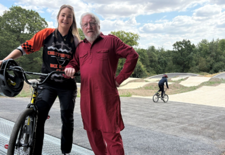
We caught up with Paul Chapman, Owner of the local lifestyle magazine and website, S40 Local, who loves cycling, to tell us more and share one of his favourite routes.
Why do you love cycling?
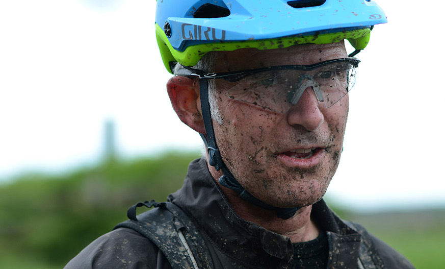
Where do I start, and how many words do you want was my initial reaction! Why? Simple. I just love to cycle, always have, and always will.
Cycling when I was young was how you got to your friends after school. There were a few years when I abandoned the bike as motorbikes and cars took over. But it wasn’t long before my commute each day across Nottingham to Boots Head Office involved cycling.
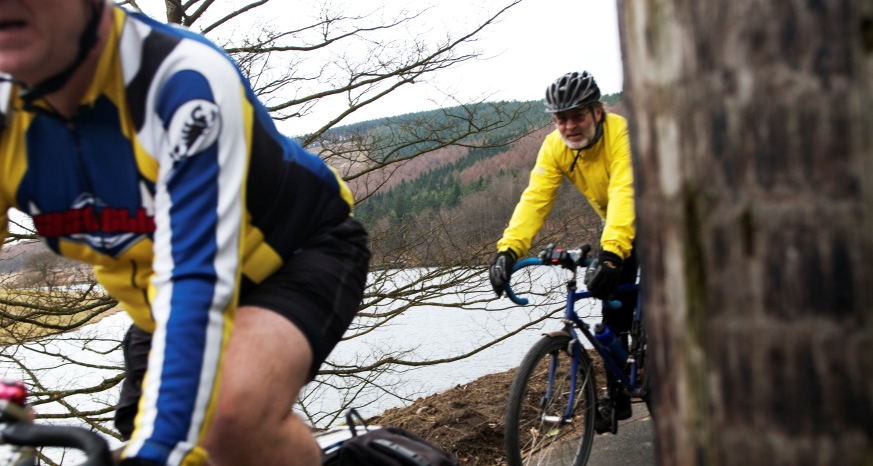
7 am, slicing through winter traffic and dropping onto quiet cycle paths and towpaths through the suburbs is fab. There isn’t anything like it. It’s a real wake-up before work. The introduction of the mountain bike had me driving up to the Peak District every weekend. And this was before any form of suspension on a pushbike! This was painful stuff, but still addictive.
Years later, I now live on the edge of the Peak District, with 25 minutes of pedalling from my front door, and I can be at the top of Beeley Moor; the hills and valleys looking like all my favourite toys spread out on the lounge floor!
I’ve competed a few times, but only for a bit of fun; I’ve never been that quick. But now I’m regularly competing with my son to get the odd King of The Mountain (see Strava). But mostly I just try to hang onto his back wheel downhill as I watch a vision of my past youth. He’s blind to the dangers involved and loving it as much as I do.
Why is Chesterfield a great place to Cycle?
Chesterfield is a great place to ride. We have some very useful bits of infrastructure and a network of bridleways that take you away from the tarmac. I’ve drawn up an 11-mile route around the west side of town, which is at the end of this article. Strava says it’s 14% road, 55% dirt, and 31% unclassified. It should take you around an hour and you can explore the town and surrounding areas.
How do you plan your cycle routes around Chesterfield?
Why not download the map of Chesterfields’ cycle routes? Take a browse and see if you could use a bike for your commute or escape to the quiet lanes.
Check out some ideas for bike rides and cycle routes around Chesterfield
Paul’s 11-mile cycle route around Chesterfield
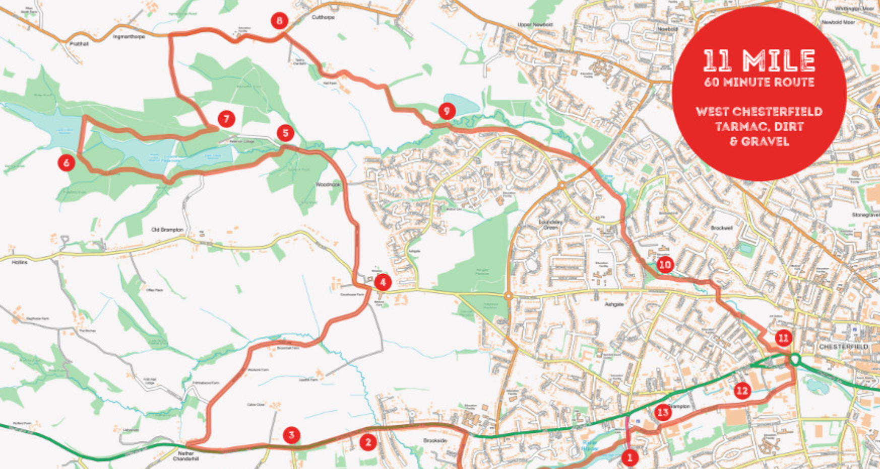
- Start at the entrance to Walton Dam (1) and ride through to Somersall Park (Hipper Valley Route) and the car park on Somersall Lane. This track is good in summer, but after rain or in the winter can be muddy.
- As you leave Somersall Park turn right up Somersall Lane; this is one of the few road sections.
- In the end, turn left and proceed East up Chatsworth Road, again on the road.
- At the junction with Brookside Barr (2) the pavement becomes much wider and it’s usually possible to ride safely using this until you reach the junction with Holymoor Road. Please keep a look out for any cars leaving or entering driveways and pass any pedestrians courteously.
- Reaching Holymoor Road, cross to the pavement on the opposite side of the road and continue up to Westwick Lane. There is a wide tarmac access road section that keeps you off Baslow Road until you reach the garage.
- Turn right, back on yourself and you’re now on Westwick Lane, away from the busy roads you can continue along here until you reach Ashgate Road (4), take a left for 100 metres, and then cross to join the well surfaced bridleway, Woodnuck Lane, that will take you into Linacre reservoirs.
- Take care on the descent; it can be a bit slippy when wet but is safe enough if you take your time.
- Dropping into Linacre, you will approach an old bridge with a wide uphill path on the left, (5) take this and climb to reach the lower reservoir where you need to take the middle path through the gap in the fence to join the concessionary path around the lower, and onto the middle reservoirs.
- As you see the top reservoir turn right across the front (6), please do not ride around the top reservoir as it is a wildlife area and cycling is not permitted on this path.
- As you reach the far side of the reservoir, turn right downhill and follow this path until you reach a gate (7).
- Through and turn left, follow this steep tarmac climb to its end with the B5060 Main Road, Cutthorpe, and turn right. Again, although there are suitable paths and tracks from the reservoir, there are no bridleways so the cyclist is forced to take a short road section.
- Pass The Peacock at Cutthorpe, or perhaps call in for a refreshment! As you pass the Peacock you round a left-hand bend, shortly after this, you need to turn right into Greenlane. (8)
- Drop to Holmebrook Valley Park. Take care through Hall Farm as it can be muddy, or if you time it badly, the cows may have crossed!
- As you enter the woodland at the bottom of this track, stay right and follow the bridleway until you see the fishing pond at Holmebrook Valley Park.
- Take a right turn over a bridge (9) then immediately left to follow the trail, take care as you cross the car park entrance and pass under Loundsley Green Road.
- Round the edge of the playing field to reach Pennine Way, where care must be taken to cross the road and pick up the marked cycle route signposted into the town centre.
- Cross Purbeck Avenue and be sure not to miss the left turn to pop out on Ashgate Valley Road (10).
- Turn right onto Holmebank East, cross Ashgate Road, and proceed down Chester Street for a few hundred metres. Shortly after the park, you need to look out for a left-hand turn that will take you on a cycle trail towards town, passing behind the old gas cylinders (only one left).
- Take the right at the end of the path and around the edge of the car park for the bingo hall.
- You will arrive through an arch onto Chatsworth Road at Wheatbridge (11).
- Follow the cycle route across the path around the island and then over the traffic lights at Wickes.
- Stay slightly left and take the short path to reach Dock Walk and turn right following Dock Walk.
- Continue onto Goyt Side Road (12) and carry straight on along the cycle track through the old Walton Works site.
- At the end turn left along Walton Fields Road (13) then immediately right to join Bobbin Mill Lane.
- Stay on Bobbin Mill Lane by turning left to meet Walton Road and back to your starting point at the dam.
Find out more about getting on your bike in Chesterfield.